Hey everyone! Picture for attention! In spirit of the holidays, we have decided to hold another raffle for Dr. Bobby Boessenecker’s team at the College of Charleston’s Mace Brown Museum! This time though – We are going to be raffling off the following:
1st place – 5 HOUR CREEK EXCURSION (redeemable 1 time for use by single adult (can bring one friend) or family.
2nd place – An official signed print of one of Dr. Boessenecker’s own paleontology illustrations, a small sifter, and 2 pounds of premium micro-matrix
3rd place – An official signed print of one of Dr. Boessenecker’s own paleontology illustrations and 1 pound of premium micro-matrix
Tickets are $10 each! To enter just send money to Venmo – @CarolinaMegHuntress or PayPal – Stillsr@usca.edu with your name!
We will end the raffle on December 11th at midnight and will announce the winners on the 12th by 6pm! All proceeds will be donated to Dr. B’s team to be used towards funding future prep-work for fossils and research! I have included a few pictures for examples of Dr. B’s work! Let the fun begin!
One of the most frequently asked questions we hear from clients is “Why are there so many fossils in Summerville, South Carolina and how did they get here?” Well, in order to answer that complicated question, I decided to prepare this article.
Today, the Coastal Plain of South Carolina is covered in forests with a semi-flat topography towards the coast and a “rolling hill” effect moving towards the midline of the state with the Summerville and Charleston areas being located at the low-point of elevation in terms of a side-to-side view of the topography of the Coastal Plain.
In other words, if you were to create a 3D model of the topography of the Coastal Plain of South Carolina and then look at it as if you were standing on the beach looking towards Columbia, the Summerville and Charleston area would appear to be sitting within the “V” of elevation with the elevation ascending in all directions towards South Carolina state lines. Of course, there are other areas of the state that would fit this profile as well, such as Colleton County, Beaufort County, etc. as all of these areas make up what is known as the Lowcountry of South Carolina.
Now let’s jump back in time to around 60 million years ago – a time known as the Eocene. South Carolina would have looked significantly different during that time. The Eocene was a time of high sea level, during which the coastline of South Carolina was located all the way in Columbia – which is now located at the mid-point of the state – more than 120 miles from where the coast line sits today. During this time, the lower region of the modern Coastal Plain of South Carolina was deep Ocean and nothing more than a dark sea that was home to micro-foraminafora, cow-sharks, and goblin sharks, and other deep-sea dwelling creatures.
As the years passed by the ocean remained high, with the modern day Coastal Plain remaining deep Ocean for millions of years. Over this time, countless micro-foraminafora died and settled to the bottom of the ocean floor, slowly building up the ocean floor to create a limestone formation that is several hundred feet thick. The Eocene limestone strata are divided into three units (layers) – the Harleyville Formation, Parkers Ferry Formation, and the Tupelo-Bay formation.
The Harleyville formation is a dark green limestone and clay layer and represents the uppermost (or latest point of) the Eocene. The Parkers Ferry formation is a yellow limestone that separates the Harleyville formation and the Tupelo-Bay formation. The Tupelo-Bay formation is the thickest Eocene unit in South Carolina and is several hundred feet thick and is where many of the Eocene-whale specimens housed in museums around the state of South Carolina. The only known exposures of the Eocene units in South Carolina are located within the Cement quarries of Harleyville South Carolina.
Towards the end of the Eocene, the earths climate fell into a state called an “Icehouse” effect. During this time massive continental sized ice sheets formed, lowering the volume of water in the Oceans and causing sea levels to drop. As a result, the earth suffered a mass extinction event known now as “the Lost Extinction”.
The name “The Lost Extinction” comes from the fact that this Extinction event remained in the shadows until recent years. It is only in the last year in fact that we have seen enough documentation of the event to support the naming of this event into the M.E.’s of earths history. During “The Lost Extinction” the climate on earth was undergoing such extreme changes that it inevitably forced the biggest player in evolution out of its cave and back into ecosystems all around the world – environmental pressure.
Over the next few million years the world’s Oceans saw a decrease in productivity, changes in migratory patterns and feeding cycles, disconnections between prey and predator, the Extinction of multiple species, and the rise of new species. It is during this time that we see the extinction of the Archaeocetes and the rise of the Archaeomysticetes (the first filter feeding whales and ancestors to modern Baleens) and Odontocetes (toothed whales that bore a stronger resemblance to modern dolphins than to their ancestors the Archaeocetes). It was also during this time that we saw the fall of the Carcharocles auriculatus (great-grandfather in evolution to the megalodon) and the rise/evolution of the Carcharocles angustidens.
33.9 Million Years – The birth of the Oligocene
It is 33.9 million years ago, the dawn of the Oligocene, and the Coastal Plain of South Carolina is once again submerged beneath deep Ocean. This time however, the coast line ends just below Harleyville, South Carolina and although the Summerville and Charleston areas are still deep Ocean, the water depth is roughly 100 feet shallower than it was towards the beginning of the late Eocene (35 million years ago).
The Oligocene formations are a very important feature of South Carolina – South Carolina is one of only a handful of locations around the world where the Oligocene marine strata are landlocked – meaning that they can be studied on dry land. Why is this important? Because it was during the Oligocene that we saw the rise of the ancestors to modern dolphins, whales, and sea-turtles. It was during the Oligocene that we saw the birth of the first Baleen whale, the first Xenorophid, the first Waipatiid, and so much more! Okay, let’s fast forward a few million years.
We are now at 26-23 million years and the climate is once again changing bringing about a fall in sea levels. We can see this shift today through the study of geologic strata such as the Ashley Formation (a thick limestone layer representing the early to mid Oligocene) and the Chandler Bridge formation (a clay and sand layer representing the later portion of the middle Oligocene through the late Oligocene). The Chandler Bridge formation represents a time in South Carolinas history when much of the modern Coastal Plain was the equivalent of salt water marshes and inter-tidal zones. The contact point of these two strata can be observed in many locations throughout the Summerville area of South Carolina in creek bed exposures and the occasional construction site. The Chandler Bridge formation is perhaps one of the most important Oligocene marine units on the Eastern seaboard.
Within the Chandler Bridge formation lies the secrets of evolution of most modern dolphins and the secrets of the grandfather in evolution to the Megalodon – The Carcharocles angustidens. Dr. Bobby Boessenecker’s research team at the College of Charleston recently published a paper on the existence of a C. angustiden nursery that was found right here in Summerville South Carolina. An amazing discovery that showed key similarities to today’s thriving ecosystems and shark nurseries found off of our coast today. Fast forwarding again.
The Miocene – Time of the Mighty Megalodon
During the Miocene the Coastal Plain of South Carolina once again reached beyond Harleyville South Carolina, evidenced by the existence of Great Whites, Bull Sharks, Galeocerdo mayumbensis and more being found in the uppermost sand layers of the Harleyville strata. It was during this time that the Summerville and Charleston areas of South Carolina were a feeding ground for the Megalodon as by that time, what is now the Coastal Plain of South Carolina was home to a diverse population of fish, whales, dolphins, and sea cows thriving in warm and shallow Coastal waters – the ideal temperate habitat for a thriving Coastal ecosystem. Over the course of millions of years Megalodon and other large sharks fed on their prey, shedding trillions of teeth that became buried on the sea floor – only about 1% of these would go on to become fossilized. Fast forwarding again –
The Final Fall
Around 3 million years ago the sea level began to rapidly fall (Coastal regression in scientific terms). With the rapid falling of sea levels and high tectonic activity came continental breaks- shifts/cracks in the continental shelf off the coast. These continental breaks led to continental deposits – large non-conformities/strata that covered thousands of square miles and that contained countless fossils. But wait, there’s more
As sea level continued to fall, the Coastal Plain of South Carolina began to look more and more like what it does today. Rivers formed at the deepest points of elevation, bringing about the erosion of nearly all of the true Miocene formations that once covered the Coastal Plain along with much of the upper Oligocene units. In addition to erosion by rivers, the Coastal Plain was subjected to several rises and falls in sea level within a short time which again contributed to even further erosion of strata across the Coastal Plain. With the erosion of these strata came the erosion of the fossils that they contained. Once caught in the currents of rivers, fossils would be tossed and tumbled along the river-beds until they hit an obstruction in the water column that would allow for them to stop – this process led to the slow build up of what we refer to as gravel beds.
Over time, many of these ancient rivers dried up or became swamps. The rivers that still exist today were once 3 times the size that they are now, bordered by swamp land on all sides offering evidence to how wide they once were. With the newly dry land came terrestrial vertebrates – the Mastadon, Gomphotherium, Mammoth, three-toed horse, Saber-toothed cats, Camels, Giant Beaver, Giant Sloth, Tapir, and more. Withing a few hundred thousand years the Coastal Plain came to resemble what it does today – a thriving Coastal Habitat full of diversity. However, the shaping of mother nature was not done yet. Flooding rains and another swift change of sea level would bring destruction across the Coastal Plain at least 2 more times before things came to be deposited in the way that we see them today – allowing for a wonderfully diverse mixture of marine and terrestrial fossils of all kinds representing nearly 25 million years of geologic time to become mixed together into Lag Deposits across the Coastal Plain of South Carolina.
For a few hundred thousand years, the Coastal Plain saw peace – and then came man. With the ancient rivers all but dried up, development moved in, ditches were formed, creeks were widened, and the strata bearing these ancient gravel beds were once again exposed.
Today, the ditches, creeks and rivers surrounding Summerville sing the songs of ancient life with the fossils they contain. Waters rushing through these channels brings fresh material to their beds, shedding light to the life that once lived here. Imagine the force of nature bearing down on a gravel deposit consisting of millions of years of history, grabbing hold of any lose material and tearing it out into the current – these are the things that the Legends surrounding Summerville Fossil hunting are made of.
Not every creek will contain fossils, and that’s where our research and years of experience come into play. With a combined 75+ years of experience, our team has studied the Coastal Plain more than anyone alive today. We have tracked through every forest, every swamp, and every creek to find exposures of ancient life and to better understand how and why these deposits came to rest where they are today.
So in other words, the Summerville area acted as a catch basin for millions of years of fossils that were eroded from multiple different strata and then deposited into lag layers distributed throughout the area (lag layers are reworked layers of material). It is true that Summerville is one of the top 3 destinations for fossil shark tooth collectors from around the world – and now you know why.
I have to also point out that my article is a “lamens- terms” summary of the years and years of research conducted by geologists (one of the most renowned of which is Dr. Rob Weems) and paleontologists across the state in combination with the years of knowledge and experience of our team. Until next time, Happy Hunting!
The specimen was home and ready for prepping – so what comes next? Well it started with cutting open the jacket to once again expose the specimen to the sunlight. Next, it was time to brush away the loose dirt and work the material down to the solid matrix with the bone exposed. I completed these tasks using the “old school paleontology” method of a paint brush and blowing lightly every few strokes. As I worked the material down, I began to see her bone and thought to myself how amazing it was to be the first human to have ever laid my eyes on her. How amazing it was to think that this beautiful creature lived 28 million years ago, 27.8 million years before the human species came into existence as the species that we are today. Her bone lay shattered and yet articulated all at once within her death bed as I dusted the matrix away. Next, it was time to apply a light acid spray over the matrix around the bone to soften the material enough for me to work it. This part of the process is particularly fascinating as the acid causes the matrix to fizzle and break apart. I repeated this process several times over the course of the day until finally, the bone lay pedestaled all of the way down the length of the block – she was ready to be removed. Carefully I began to remove each piece. Piece by piece, removed from the matrix and layer down against a grid line so as to keep the pieces aligned appropriately for the upcoming reconstruction process. Next, I carried the material over to a wash station and used a soft bristled tooth brush to slowly remove the remnants of the matrix and ready the pieces for glue application. Finally, it was time to put her back together and restore her to her former glory. As I reconstructed her bones I slowly watched her coming back to life – telling the story of her life. The worn down enamel crowns showing that she had a hearty diet, that she was an older dolphin that had probably seen many years of babies and many years of an ancient Ocean long gone through the phases of evolution and climate change. A few days later and it was time to carry her to the Mace Brown Museum at the College of Charleston for donation. A bittersweet moment but a significant one nonetheless. See, this particular Waipatiid specimen showed unique signs of a particular type of feeding wear that indicated a certain type of feeding habit that the College was interested in researching. As I handed her over to Dr. B I felt proud in knowing that I had saved her from the destruction of construction equipment and happy to know that she was to be used for furthering future paleontological research. One day there will come a paper that will include scientific notes on her life and what her bones could tell us and that, that is what it’s all about ❤
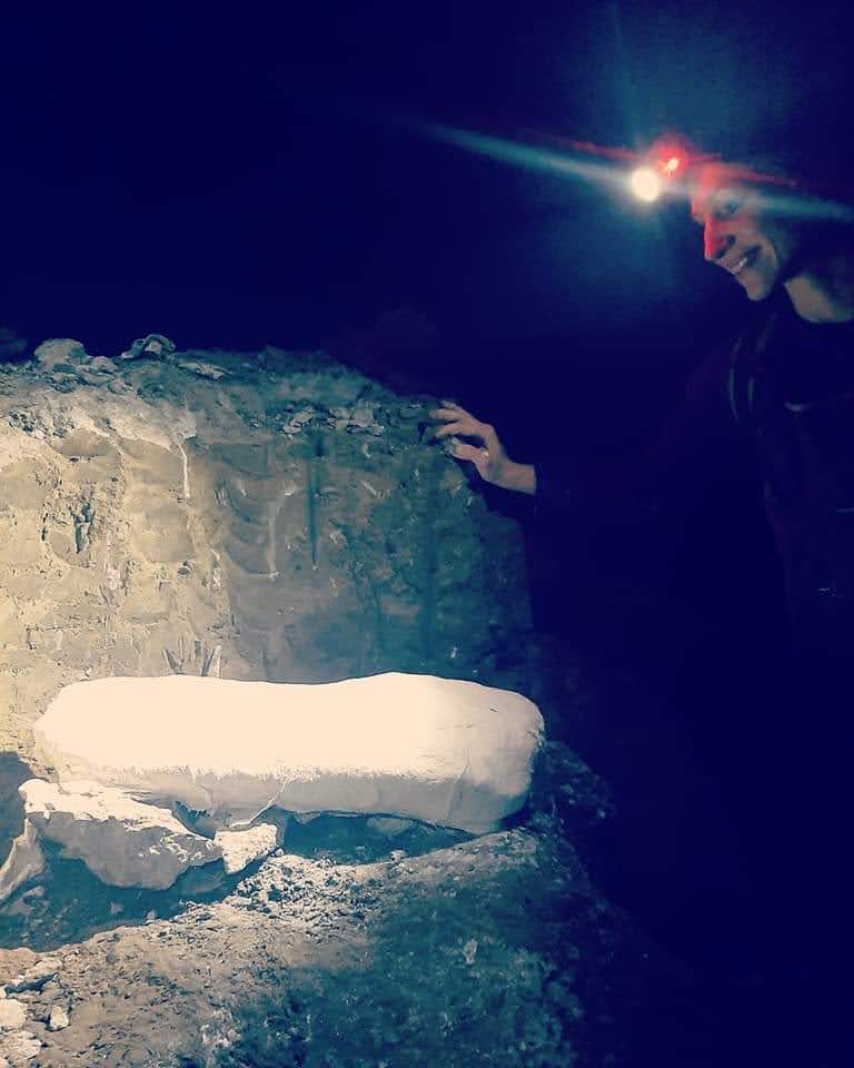
We were out scouting a new construction site when I noticed a section of thin bone material jutting out of the wall of the retention pond which I immediately recognized to be jaw bone. I paused for a moment and then giggled with excitement and decided to set my things down and get to work. The first thing I needed to do was check the area for other signs of bone to see if I could find any clues as to what the animal might be or if there might be any pieces of the bone laying somewhere nearby.
The tractor had struck the animal while digging the pond and I knew firsthand that there could be fragmented bone laying in the limestone at the base of the wall and I would need to collect the material before getting to work on the jaw bone. Within a few minutes I located a vertebrae that appeared to be associated about 3 feet from the jaw and a few badly fragmented bone shards laying at the base of the wall. I carefully put the bone shards away and pulled out my kit – chisel, rock hammer, and shovel – and set to work.
The first thing I needed to do was remove the overburden from above the animal to determine how far back into the wall the jaw went – I used my shovel and rock hammer to do this part. Next, I needed to trench out an area around the jaw so as to create a pedestaled block that I would be able to safely remove. Since there was no other bone laying near the jaw I was able to move relatively quickly through this part of the process.
Once the trench was in place, it was time to cover the block with plaster of paris strips. The strips hardened within 15 minutes and provide stabilization to the block so that when flipped, the material is held in place and the structural integrity of the fossil is preserved. For this part I had the assistance of my husband Joshua Basak. Suddenly it began to rain and Josh and I began our race against the clock to get the specimen removed in fear that the weather would soon take a turn for the worse.
Next, it was time to pull out the power tools – time for the SawZall. Using a 12″ reciprocating blade on a 20v SawZall, I placed a cut line roughly 4″ below the settling line of the bone so as to ensure that I would not cut through any of the animal. Next, we flipped the block and applied the plaster of paris to the under-side of the block, finally sealing it and making it ready to carry out of the pit.
As I picked up the tools and loaded the bag, the rain began to come down harder and we realized we only had a few minutes left to get the block to the truck. Without hesitation, Josh reached down and scooped the block into his arms and began the 200 yard journey across the floor of the hard-pan bottomed retention pond through 2 feet of water. Nervously I followed behind him carrying the 80 pound bag of tools, praying he made it to the truck before the sky let loose completely. Within minutes we arrived safely at the truck and were on our way home to begin the next part of the journey.
Stay tuned for the Waipatiid of the Ashley part 2 and as always – Until next time, Happy Hunting!